Hexagon, Fujitsu Develop Digital Twin Applications to Predict Natural Disasters and Traffic Accidents
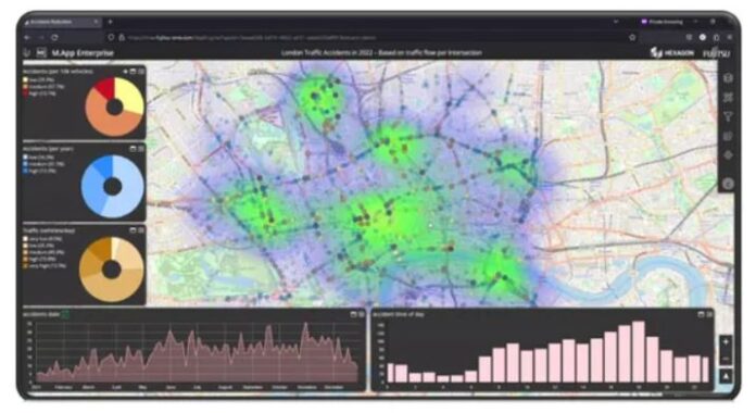
Hexagon’s Safety, Infrastructure & Geospatial division and Fujitsu Limited have announced the development of digital twin applications for predicting and mitigating natural disasters and traffic accidents. The solutions, based on a partnership formed last year, reflect the two companies’ ongoing efforts to realize resilient, disaster-resistant cities. Use cases were presented this week at HxGN LIVE Global 2023 in Las Vegas.
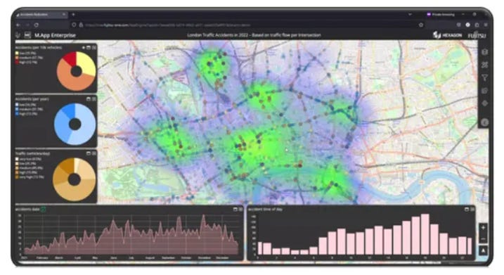
The two companies said they are developing a prediction model that calculates the extent and impact of flooding from precipitation data, visualizes the extent of flooding and performs damage prediction analysis. To support traffic safety, the companies have focused on an application that identifies areas where heavy traffic and road design heighten the risk of accidents and proposes measures for improvement.
Contact: Hexagon, www.hexagon.com.
Comtech and E-Space Partner
Comtech CMTL 5.89%↑ and E-Space are partnering to collaborate, develop and deploy space-based communications solutions and IoT services to support predominantly government and targeted commercial customers. The collaboration will leverage Comtech’s portfolio of technologies and strategic partnerships, coupled with E-Space’s future advanced space system, inclusive of its global low Earth orbit (LEO) constellation and unique device capabilities, the company said.
Contact: Jamie Clegg, Comtech, (480) 532-2523, jamie.clegg@comtech.com, www.comtech.com.
AT&T and HAAS Alert Collaborate
AT&T T 1.36%↑ and HAAS Alert plan to bundle digital alerts from HAAS Alert’s Safety Cloud cellular vehicle-to-everything (V2X) service with AT&T connected vehicle solutions for automakers to deliver hazard and roadway alerts to drivers. HAAS Alert’s Safety Cloud is the largest cellular V2X solution in deployment, connecting emergency vehicles, roadway infrastructure, and other transportation assets together, the company said.

The AT&T and HAAS Alert collaboration opens up new opportunities for advanced cellular V2X applications including smarter traffic management, emergency vehicle prioritization, and data-driven solutions that generate new insights into traffic patterns and road conditions, the company said.
Contact: AT&T Connected Solutions, www.business.att.com.
10,000 Pallets Tracked By Sigfox Technology
AJ Networks has connected 10,000 plastic pallets on AMO-SNet’s 0G Network powered by Sigfox 0G technology. The announcement marks the first asset tracking system in South Korea’s pallet pooling business using a tracker designed by ALPS, the company said.
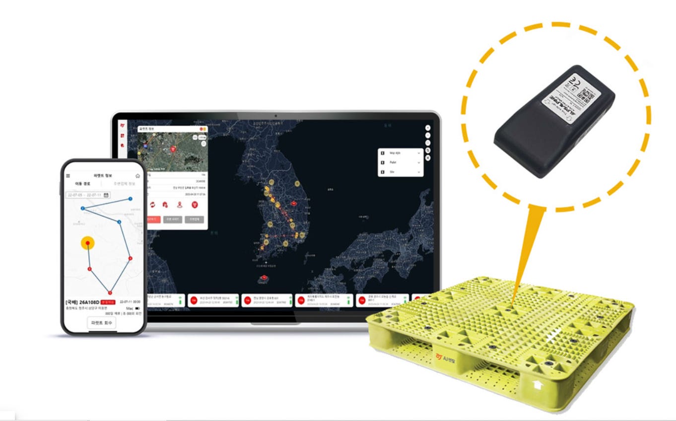
Traditional asset trackers that rely on 3G and GPS are usually not suitable to track returnable assets such as pallets as 90 percent of them are usually found indoors, out of reach of GPS signals, the company said.
Contact: UnaBiz, www.unabiz.com.
U-blox Rolls Out New GNSS Modules
Thalwil, Switzerland-based u-blox [UBXN] has launched two modules based on its F9 GNSS platform. The NEO-F9P supports navigation and automation of moving industrial machinery, while the ZED-F9P-15B provides customers in the mobile robotics market with an L1/L5 option in addition to the L1/L2 bands, the company said.

The new u-blox NEO-F9P GNSS module features reception from GPS, Galileo, and BeiDou, multi-band L1/L5 RTK and short convergence times. The NEO-F9P is suited for precise navigation and automation in smart antennas, UAVs and mobile robotics.
In other u-blox news, the company rolled out its PointPerfect Developer plan. The new Developer plan includes 40 hours of free access to the PointPerfect IP data stream
Contact: Natacha Seitz, u-blox, 41 76 436 0788, natacha.seitz@u-blox.com, www.u-blox.com.
Directed Technogies Opens $10 Million Telematics Hub
Directed Technologies has opened a $10 million Connected Mobility Innovation Center to double its capabilities in next-generation fleet vehicle digitization and electrification. The new center will also allow the company to scale into global markets, including the United States. Directed Technologies’ telematics devices are used in more than 2,500 vehicle fleets globally
Contact: Mitchell Blincoe, for Directed Technologies, mblincoe@keepleft.com.au, 61427801843, www.DirectedTechnologies.com.au.
Trimble Rolls Out X9 3D Laser Scanner
Trimble TRMB 3.16%↑ recently announced its X9 3D laser scanning system for surveying, construction and engineering professionals. The X9 is built on the company’s laser scanning technologies, which leverages its Trimble X-Drive technology for automatic instrument calibration, survey-grade self-leveling and laser pointer for georeferencing.

The new Trimble X9 expands on its Trimble X7, but delivers longer range, higher accuracy, shorter scan times and exceptional sensitivity, improving scan results and boosting productivity, the company said. The X9 provides time savings, with accurate and dependable data, through in-field registration within Trimble Perspective and Trimble FieldLink, the company said.
Contact: Trimble, www.geospatial.trimble.com/X9.
Parkopedia Partners With Plugsurfing
Parkopedia has partnered with Plugsurfing to integrate Plugsurfing’s Drive API into Parkopedia’s in-car Payment Platform. This allows drivers to locate, start and pay for charging at more than 500,000 charge points across Europe and the UK, the company said.

The partnership calls for Plugsurfing handling all payments and ensuring PCI compliance, while Parkopedia integrates EV charging payments with broader in-car payment services, the company said.
Contact: Adam Calland, Parkopedia, 44(0)7838219129, adam.calland@parkopedia.com, www.business.parkopedia.com.

Create a FREE ManyMe Account.
Leica Geosystems Rolls Out CountryMapper
Hexagon’s [HEXA B] Leica Geosystems has introduced CountryMapper, which combines a large-format photogrammetric camera with a high-performance lidar unit into a single system, the company said. CountryMapper collects foundational geospatial data simultaneously, enabling the generation of data products for a host of user applications.
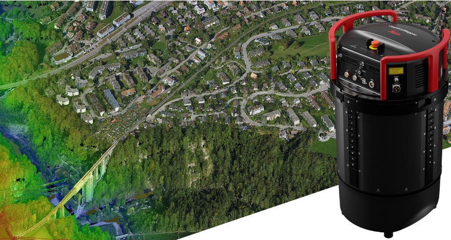
CountryMapper features a CMOS-based Leica MFC150 camera to leverage true mechanical forward-motion-compensation (FMC) to deliver image quality, even at faster aircraft speeds and in challenging lighting conditions, the company said.
Contact: Cristina Mauri, Leica Geosystems, cristina.mauri@hexagon.com, https://leica-geosystems.com.
Cirium and Aireon Extend Partnership
Cirium has extended its agreement with Aireon to offer live and historical aircraft positional analytics for advanced situational awareness and post-operations analysis. Cirium is integrating its schedule, fleet, flight status, weather and emissions data with Aireon’s global satellite-based coverage of flight positions, the company said. Aireon’s satellite-based positional data provides coverage of all modern aircraft, equipped with ADS-B, anywhere in the world, the company said.
Contact: Cirium, cirium@juliettalpha.com.

The Institute of Navigation’s Johannes Kepler Award nominations are due June 30, 2023. The purpose of the award is to honor an individual for sustained and significant contributions to the development of satellite navigation, ION said. The winner of the award will be determined by a special nominating committee.
Contact: Institute of Navigation, www.ion.org/awards/kepler-award.cfm.
TCarta, Maxar Deliver Satellite Bathymetry to NGA
TCarta Marine has been awarded a contract to deliver satellite derived bathymetry (SDB) and seafloor classification data for the coastal zones of 13 regions around the world to the National Geospatial-Intelligence Agency (NGA) under contract with Maxar Technologies MAXR 0.00 . TCarta will deliver seabed depth and feature maps from multispectral Maxar WorldView-2 and WorldView-3 satellite imagery. SDB measurements are accurate to depths of 20-30 meters depending on water conditions, with two-meter spatial resolution, the company said.
Contact: TCarta, www.tcarta.com.
HYFIX.AI Launches New RTK Rovers With Quectel LC29H GNSS Module
HYFIX.AI has launched a new family of Real-Time Kinematic (RTK) Rovers on CrowdSupply. The Rovers are specifically designed for IoT and mobile robotics using the LC29H module from Quectel Wireless Solutions. The RTK Rover is offered in both a simple USB interface version and a more powerful Raspberry Pi4B Ethernet version with data logging features, the company said.
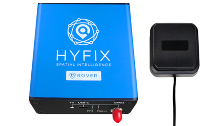
The CrowdSupply pre-order pricing is $195 for the USB Rover and $395 for the Pi4B/Ethernet Rover. The Quectel LC29H module is a surface-mount low-power 135-channel dual-band receiver.
Contact: Quectel, media@quectel.com, www.quectel.com.
Infleqtion Demonstrates Accelerometers For PNT Applications
Infleqtion, working with a University of Colorado team, has demonstrated a software-configured, quantum-enabled high-performance accelerometer by combining machine learning with quantum sensing. It is designed for PNT applications that operate under accelerations up to several tens of times the Earth’s gravity.

The accelerometer demonstrated a sensor volume reduction of greater than a factor of 10,000 times compared to the current state-of-the-art technology, the company said. These results highlight the future of quantum sensing as a high-precision alternative to satellite-based GPS signals, the company said.
Contact: Infleqtion, www.Infleqtion.com.
CONTROLTEK Offers Online RFID Resource Center
CONTROLTEK has launched an Online RFID Resource Center that includes inventory management, asset tracking and RFID. Overall, the center allows businesses a comprehensive online hub for RFID information and education. The platform will host a collection of educational articles, case studies, white papers and industry reports.
Contact: Chris Watros, Chris.Watros@controltekusa.com, www.controltekusa.com.

If you’re a student in the US looking for a better way to pay for higher education, Bold provides thousands of students with $25k scholarships every year. Enter to win one of our monthly $25,000 scholarship to go towards your tuition, student loan debt, or other education related expenses!
Apply to a Bold scholarship today
People
- NextNav NN 2.97%↑ has named Mary Lee Sharp as vice president of people. Sharp was senior vice president and chief human resources officer of National Mortgage Insurance.
- Yuval Kossovsky has joined Mappedin as vice president of global partnerships. Kossovsky’s most recent role was Apple’s AAPL 0.36%↑ head of global partnerships, Maps.
- Spirent Communications has appointed Rajesh Pathak as country managing director for India and SAARC.
Jobs
Senior PR and Communications Manager. Advanced Navigation.
Head of Marketing. Advanced Navigation.
Business Development Executive. Advanced Navigation.
GNSS/INS Sales Director EMEA. Septentrio.
Project Manager. Septentrio.
Global Sales Director. Trimble.

Click HERE to Join our growing Location Business News LinkedIn Group!


