LocatorX Awarded Multi-Million-Dollar Sub-Contract to Provide DLA Inventory Visibility
LocatorX was awarded a sub-contract as part of a multi-million-dollar Phase III Small Business Innovation Research (SBIR) award by the Defense Logistics Agency (DLA). The company will provide a location solution that is part of a project that will provide visibility and automated inventory management system to DLA Distribution Centers, the company said. The solution will allow DLA, among other capabilities, to improve the efficiency of physical inventories, receipt processing, and warehouse materiel tracking, the company said.
Contact: Jody Spencer, LocatorX, jody.spencer@locatorx.com, www.locatorx.com.
Lotus Robotics and HERE Technologies Partner on Highway Navigation Pilot for Automated Driving
Lotus Robotics and HERE Technologies have signed a memorandum of understanding to develop an advanced Highway Navigation Pilot solution that delivers Level 2+ automated driving functions. The solution is set for a 2025 launch in Europe. The solution, powered by HERE HD Live Map, will be used in upcoming Lotus vehicles and jointly offered to automakers across Europe, the company said.
Contact: Weizhou Wu, Lotus Cars, 86-159 1071 0170, weizhou.wu@lotuscars.com.cn.
u-Blox’s ZED-X20P All-Band GNSS Module Available in ArduSimple’s simpleRTK4 Optimum Solution
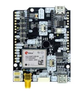
Thalwil, Switzerland-based u-blox and ArduSimple have announced the simpleRTK4 Optimum solution featuring the u-blox ZED-X20P GNSS module. The module supports all GNSS bands (L1, L2, L5, L6, and integrated L-band).
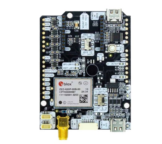
The integration of the ZED-X20P module into ArduSimple’s product lineup offers centimeter-level positioning accuracy, the company said. Potential markets include precision agriculture, robotics, and geospatial surveying. Available now for order, the solution is easy to use and integrates seamlessly with popular platforms such as Arduino, STM32, Raspberry Pi, Pixhawk, and Jetson processors.
Contact: Sven Etzold, u-blox, 41 76 561 0066, sven.etzold@u-blox.com, www.u-blox.com.
ProStar and Emlid Partner to Deliver Centimeter Accuracy for Infrastructure Mapping Worldwide
ProStar Holdings and Emlid Tech Kft have partnered to bring centimeter-level precision and cost-efficiency to the mapping of underground utilities and other critical infrastructure. The partnership is designed to offer ProStar’s PointMan platform, powered by Point One RTK correction services, with Emlid’s lightweight and survey-grade GNSS receivers, the company said. The Emlid Reach RX is a pocket-sized RTK GNSS receiver providing ultra-fast setup with no configuration required, the company said.
Contact: Page Tucker, ProStar, ptucker@prostarcorp.com, www.prostarcorp.com.
Carbon Robotics Introduces Tractor Autonomy Solution with Real-Time Remote Supervision and Control
Carbon Robotics has announced the launch of AutoTractor tractor autonomy solution. Powered by Carbon AI, Carbon AutoTractor is installed on existing tractors and is remotely monitored by Carbon Robotics operators.
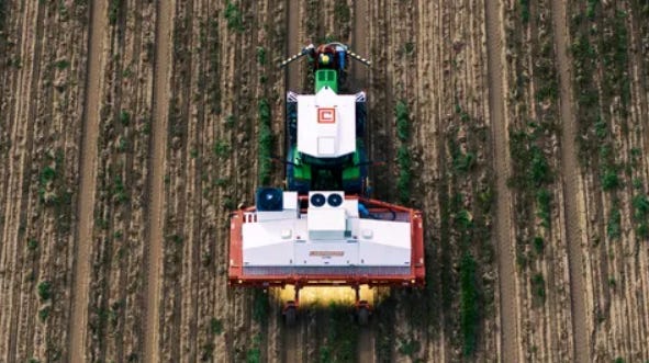
Developed with direct feedback from farmers, Carbon AutoTractor addresses the key barriers that have prevented the widespread adoption of tractor autonomy: frequent stoppages requiring farmer intervention, complex supervision and management, and unreliable solutions not built for 24/7 production operations, the company said.
Contact: Rachael Dowd, Carbon Robotics, (206) 282-4923, ext. 115, carbonrobotics@communiquepr.com, www.carbonrobotics.com.

Create a FREE ManyMe Account.
Teledyne CARIS Demos Marine Lidar Acquisition
Teledyne CARIS will be presenting a live demo, in collaboration with Teledyne Marine, at Ocean Business 2025 in the National Oceanography Centre, Southampton, United Kingdom, from April 8-10. The live demo, which will be aboard Teledyne Marine’s vessel, will acquire data and stream it live to the CARIS stand using CARIS Onboard, the company said.
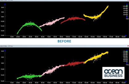
This demonstration will also feature lidar acquisition from the Teledyne Optech CL-360M lidar for scanning the shoreline, the company said. Also on display will be the Optech Fathom topobathy lidar solution.
Contact: Jennifer Parham, Teledyne, jennifer.parham@teledyne.com.
The Connected Commercial Drone Market to Reach $37.3 Billion by 2029
Berg Insight’s new report says that the global market for connected commercial drones is forecasted to grow from $18.6 billion in 2024 to $37.3 billion in 2029. The market is led by China-based DJI, which has an estimated 70 percent market share of the global drone market as of 2024, the company said. “The commercial drone market is set for a consolidation journey in the upcoming years as many application areas are fragmented,” the company said.
Contact: Johan Fagerberg, Berg Insight, 46 31 711 30 91, johan.fagerberg@berginsight.com.
GiraffeG4 Sentinel System Is Awarded Its Fourth US Patent
The GiraffeG4 Sentinel System’s Tracking App is tailored to local fleets in a designated geographic area, the company said. The new patent focuses on the Sentinel System‘s ability to create a database for a local fleet of vehicles that use trucks in the 9-foot to 12-foot range.
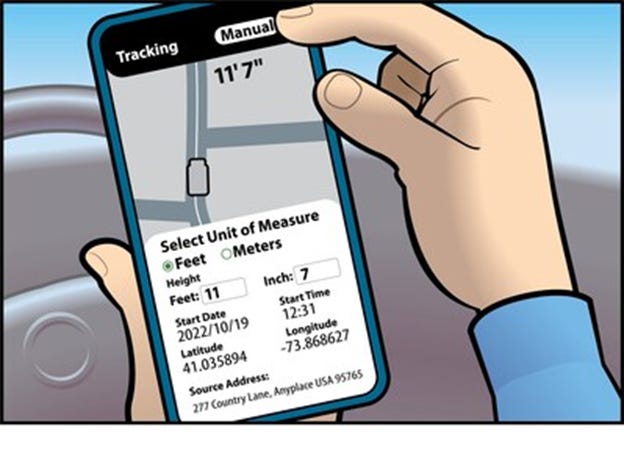
The height and GPS information is downloaded into the GiraffeG4 Sentinel System’s database, which will give a new, distracted, or lost driver an audible warning 100 yards before they reach the hazard, the company said. Markets include food delivery trucks, work vans, bucket trucks and emergency medical vehicles.
Contact: Frank Nugent, for GiraffeG4, (877) 543-1087, 392534@email4pr.com,
https://giraffeg4.com.

Click HERE to Join our growing Location Business News LinkedIn Group!
