Topcon Will Integrate GNSS Into Solutions From Bentley Systems and Worldsensing
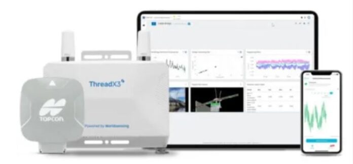
Topcon Positioning Systems has announced strategic agreements with Bentley Systems and Worldsensing to integrate its GNSS technology into the companies’ software and connectivity solutions. As part of its agreement with Bentley Systems, Topcon will provide access to its web-based GNSS processing engine for Bentley’s iTwin IoT monitoring solution.
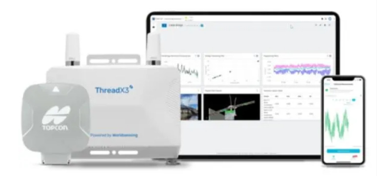
pioneer Worldsensing has integrated the Topcon AGM-1 GNSS receiver with its Thread X3 broadband product. The result creates a new Accurate Positioning System to monitor such geohazards as rock falls and landslides in pit mines, rail embankments and other ground structures, the company said.
Contact: Staci Fitzgerald, Topcon Positioning Systems. (925) 245-8610, corpcomm@topcon.com.
Quectel Launches Several Products at Embedded World
Quectel Wireless Solutions launched the BG95-S5 3GPP non-terrestrial network (NTN) satellite communication module at Embedded World this week. The module supports 3GPP Release 17 IoT-NTN in the S and L band frequencies for satellite communications. In addition, the multi-mode BG95-S5 supports LTE Cat M1, Cat NB2, eGPRS and integrated GNSS.

Quectel also launched its HCM511S MCU Bluetooth module for compact connected devices. In addition, the company rolled out the RG255C-GL 5G Redcap Sub-6GHz LGA module, delivering 5G and 4G coverage and based on Qualcomm’s QCOM -2.19%↓ Snapdragon X35 baseband chipset.
Contact: Quectel, media@quectel.com, www.quectel.com.
Telit Cinterion and Taoglas Launch Antenna Tuning Reference Design
At Embedded World 2024 this week, Telit Cinterion and Taoglas launched an antenna tuning reference design. The new board Telit Cinterion’s ELS62-W LTE Cat 1 bis + 2G module and Taoglas’ PCS.50.A tunable antenna.

The platform helps device OEMs, IoT service providers and other businesses minimize the expense and lead time of developing and launching smart sensors, wearables, asset trackers and other IoT solutions, the company said. The PCS.50.A combines aperture tuning and active switching technologies to provide wideband coverage for GNSS and most 4G cellular bands, the company said.
Contact: Telit Cinterion, www.telit.com/modules-overview/cellular-lte.
New Descartes MacroPoint Capabilities Help Combat Fraud in Transportation and Logistics
Descartes Systems Group DSGX -1.50%↓ has launched its MacroPoint FraudGuard to help freight brokers, third-party logistics companies (3PLs) and shippers identify and prevent fraudulent activities related to carrier information, load tracking, and shipment status. The new capabilities are now included as part of the subscription for the MacroPoint service, the company said. Carriers can connect with the solution via GPS-based electronic logging device (ELD), transportation management systems (TMS), or mobile app-based tracking methods, the company said.
Contact: Cara Strohack, Descartes, (800) 419-8495 ext. 202025,
cstrohack@descartes.com.
U.S. Department of Transportation’s Accelerating Vehicle-to-Everything Cohort
The Intelligent Transportation Systems Joint Program Office (ITS JPO) recently established a cohort of more than 30 public agencies that are deploying V2X technologies. The Accelerating V2X Cohort provides a forum for deployers to share their experiences, challenges, best practices, and documentation with their peers, the agency said.

“Early meetings are addressing such topics as V2X strategic planning and funding; V2X performance measures and benefits; and V2X applications and use cases,” the agency said. The cohort is also discussing open-source V2X tools developed and supported by the U.S. DOT, including the V2X Hub, MAP Creation Tool, TIM Message Creator: Traveler Information Tool, and Operational Data Environment.
Contact: J.D. Schneeberger, ITS Joint Program Office, john.schneeberger@dot.gov, www.its.dot.gov.
Septentrio GNSS Module Integrated By MIKROE
Septentrio’s mosaic-X5 GNSS receiver module has been integrated into a Click board by MIKROE. The new board, called Mosaic Click, is compatible with the mikroBUS socket standard, the company said.
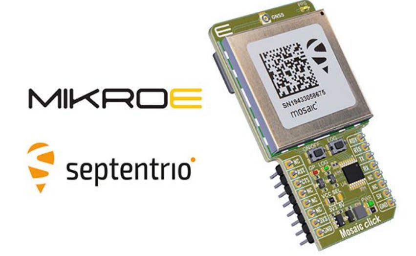
The mosaic-X5 receiver features advanced anti-jamming and triple-band GNSS technology to achieve centimeter-level RTK accuracy, even in challenging environments, the company said.
Contact: Septentrio, www.septentrio.com.
Pebblebee Set to Deliver Google’s Find My Device Compatible Products
Pebblebee has announced it is set to deliver Made for Google certified item locators that work with Android devices and Google’s Find My Device. With a crowdsourced network of more than a billion Android devices, Find My Device can help users find misplaced everyday items, even when they’re offline, the company said. The company is targeting sporting goods, travel, consumer and luxury brands.

Pebblebee’s Made for Google certified card, clip, and tag devices are rechargeable, offer extended range, and are equipped with LED indicator lights and melody alerts, the company said. All devices are OTA (Over-The-Air) updateable through a Pebblebee customized web portal, the company said.
Contact: Donna Loughlin Michaels, for Pebblebee, (408) 393.5575, donna@lmgpr.com, www.pebblebee.com.

Create a FREE ManyMe Account.
SFL Confirms Successful Deployment of HawkEye 360 Microsatellite Clusters 8 and 9
Space Flight Laboratory (SFL) said that six radio frequency geolocation microsatellites, developed for HawkEye 360 of Herndon, Va., have successfully communicated with ground control. The HawkEye 360 Cluster 8 and 9 satellites were launched this week from Florida aboard the SpaceX Bandwagon-1 Rideshare.
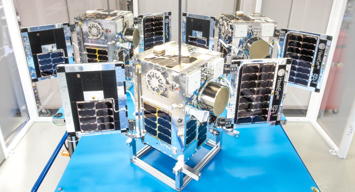
The two new three-satellite clusters bring to 27 the total number of geolocation microsatellites developed by SFL for HawkEye 360. SFL is developing the satellites’ attitude control and formation flying by multiple spacecraft for RF signal geolocation.
Contact: Robert Zee, SFL, (416) 667-7400, info@utias-sfl.net
Avineon Acquires North Point
Avineon has acquired the assets of GIS services provider North Point Geographic Solutions. North Provides GIS services to government agencies, among others. Financial details were not disclosed.
Contact: Anand Subramani, Avineon, (703) 671-1900, asubramani@avineon.com, www.avineon.com.
TRIMEDX Launches GeoSense RTLS
TRIMEDX has launched GeoSense, a Real-Time Location System (RTLS) for health care. TRIMEDX GeoSense provides health systems with medical device tracking data by using next-generation, multi-modal technology that is lightweight, room-level precise and easy to implement, the company said.
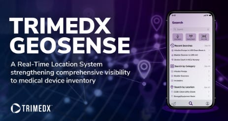
TRIMEDX GeoSense offers allows technicians to quickly locate devices for preventative maintenance and repairs and better prioritize workflows to improve service delivery, the company said.
Contact: Andrew Welch, TRIMEDX, (317) 957-5146, andrew.welch@trimedx.com.
Blueiot Recognized in 2024 Gartner Magic Quadrant for Indoor Location Services
RTLS provider Blueiot has been recognized as a Niche Player in the 2024 Gartner Magic Quadrant for Indoor Location Services. Blueiot locating system applies Bluetooth AoA (Angle of Arrival) technology to bring accuracy levels down to 0.1m, the company said. The company offers AoA anchors, wearable and light-weight tags, engines and application software for tracking vehicles and assets, the company said.
Contact: Blueiot, www.blueiot.com
People
- After 40 years in the surveying and positioning industry, Michael Ritter said he will retire at the end of April. He served as Hexagon AB’s president, Autonomous Solutions Division; president of the company’s Autonomy and Positioning division for more than 8 years; and president and CEO of NovAtel for more than 13 years.
- ORBCOMM has named Sanjay Hajela as senior vice president, integrated supply chain.
- Safran named Pier Michele Roviera as president of space solutions. Roviera previously served as a program director at Blue Origin.
- Suhas Chougule has been promoted to director of quality at HERE Technologies.
Jobs
Careers. Airbus.
Senior Project Manager. TomTom.
Product Owner. Trimble.
Staff Product Manager – IOT. Qualcomm.
Strategic Programs Manager. Garmin.
Key Account Manager India. U-blox.
Data Scientist. Mapon.

Click HERE to Join our growing Location Business News LinkedIn Group!


