TomTom and East View Geospatial to Supply Map Data for Australian Military
TomTom [TOM2], with East View Geospatial, will supply global map data to Australian Government Department of Defense. EVG leverages TomTom Orbis Maps to create an ArcGIS-ready global vector basemap, the company said.

In other company news, TomTom last week partnered with Bolt to provide traffic data for its global ride-hailing and food-delivery routing. Bolt operates in over 500 cities in Europe and Africa, with over 150 million customers worldwide.
Contact: TomTom, www.tomtom.com.
Harada to Manufacture Sigfox 0G Tracking Solution
Harada Industry has partnered with UnaBiz to design and manufacture a Sigfox 0G technology-based vehicle tracking solution and in-vehicle antenna for the automotive industry. The collaboration between Harada and UnaBiz involves joint efforts from its R&D teams to create a “Film-type Vehicle Smart Tracker” that can be attached to the windshield of automobiles, the company said.

The transparent film tracker will not obstruct the driver’s view, and its placement at the top of the windshield improves the radio wave environment, enhancing Sigfox 0G network reception, the company said. Micware will also be working with UnaBiz to develop the tracking and telemetry software platform.
Contact UnaBiz Japan, sales-japan@unabiz.com.
HERE Says Its ISA Map Is the Preferred Choice To Meet EU Intelligent Speed Assistance Requirements
HERE Technologies says its ISA Map, currently used by 70 brands from 33 vehicle makers, is the preferred choice to meet European Union’s (EU) Intelligent Speed Assistance (ISA) regulation. On July 6, the regulation will expand to all newly registered vehicles in the EU, the company said.

ISA is an in-vehicle system that utilizes real-time speed limit data to issue warnings, inform drivers, and deter them from exceeding statutory speed limits on EU roadways, the company said. Since July 2022, all new passenger and commercial vehicle types and models introduced in the EU are required to be equipped with an ISA solution.
Contact: Sebastian Kurme, HERE Technologies, 49 173 515 3549,
sebastian.kurme@here.com. www.here.com.
PTV Group to Launch New Data Platform
PTV Group will launch its PTV Access data platform that offers APIs to integrate location and mobility data into software solutions, providing value for real estate platform operators or retailers. These include powerful interfaces to deliver data from transport models as well as public and commercial sources, the company said.

Real estate platform providers can determine and integrate an index for each of their listings that indicates the accessibility of frequently visited facilities such as kindergartens, schools, restaurants, supermarkets, discount stores, pharmacies, hospitals and more. The API allows users to filter and find properties that match their daily mobility needs, the company said.
Contact: Ira Steinhoff, PTV Group, 4915152749201, ira.steinhoff@ptvgroup.com, www.ptvgroup.com.
LLumin and Azuga Partner
LLumin has partnered with Azuga to integrate Azuga Fleet with its CMMS+ software for preventative maintenance and asset management. The integration features GPS fleet tracking, vehicle diagnostics, and driver rewards. LLumin’s CMMS+ integrated with Azuga Fleet also features real-time insights to minimize downtime, expedite repairs, and reduce mean time to repair, the company said.
Contact: Valerie Harding, for Azuga, (617) 536-8887, valerie@rippleeffectpr.com.
Hastings Direct and CMT Renew Partnership
Cambridge Mobile Telematics (CMT) and Hastings Direct, a provider of insurance broking services to the UK private car, van, motorbike and home insurance markets, announced that they’ve renewed their partnership. Launched in 2020, the YouDrive program uses CMT’s DriveWell Fusion platform.

In other company news, Najm has partnered with CMT to launch a new telematics initiative in Saudi Arabia. Najm has partnered with CMT for information solutions, analyze and process advanced driving data, and provide actionable insights to reduce accidents and improve road safety.
Contact: Cambridge Mobile Telematics, www.cmtelematics.com.

Create a FREE ManyMe Account.
STMicroelectronics Integrates Ceva Cellular IoT Platform in its NB-IoT Industrial Module
STMicroelectronics has integrated Ceva’s $CEVA Ceva-Waves Dragonfly NB-IoT platform into its recently introduced ST87M01 modules that combine NB-IoT data communication with GNSS geo-location capability for IoT devices and assets. IoT use cases include smart meters, smart grid, smart buildings, smart cities and smart infrastructure applications, the company said.

The Ceva-Waves Dragonfly platform integrates a Ceva-BX1 processor, an optimized RF transceiver, baseband, and a protocol stack to offer a complete Release 15 Cat-NB2 modem IP solution that reduces time-to-market and lowers entry barriers, the company said.
Contact: Ceva, www.ceva-ip.com/product/dragonfly.
Precisely Announces New Location Services
Precisely has announced new services for the Precisely Data Integrity Suite that includes Spatial Analytics and Data Enrichment services to offer location-aware capabilities. Spatial Analytics empowers enterprises with location-based data to surface deeper, more valuable insights—including the patterns, trends, and relationships between location-based datasets, the company said. Additionally, Spatial Analytics’ insights can be easily shared through enriched business processes, maps, and out-of-the-box reports, increasing revenue growth, the company said.
Contact: Precisely, www.precisely.com.
Woolpert Contracted to Acquire Orthoimagery for Ohio
The state of Ohio has tasked Woolpert to acquire orthoimagery for its Ohio Statewide Imagery and Remote Sensing Program (OSIP) under a four-year contract. The data, collected as part of OSIP’s Statewide Imagery and Remote Sensing Data Acquisition Project, will support a range of uses, including economic development, infrastructure, conservation, and emergency response planning, the company said. Woolpert will deliver three-band natural color digital orthoimagery and establish additional optional services for state agencies and local governments, including digital orthoimagery, lidar, and photogrammetric feature extraction services, the company said.
Contact: Woolpert, www.woolpert.com.
Teledyne Geospatial Launches Galaxy Edge
Teledyne Geospatial has announced the Galaxy Edge airborne lidar solution. Galaxy Edge features high-resolution data with efficient acquisition in steep terrain, resulting in lower carbon footprint and a 20-50 percent reduction in collection costs, the company said.
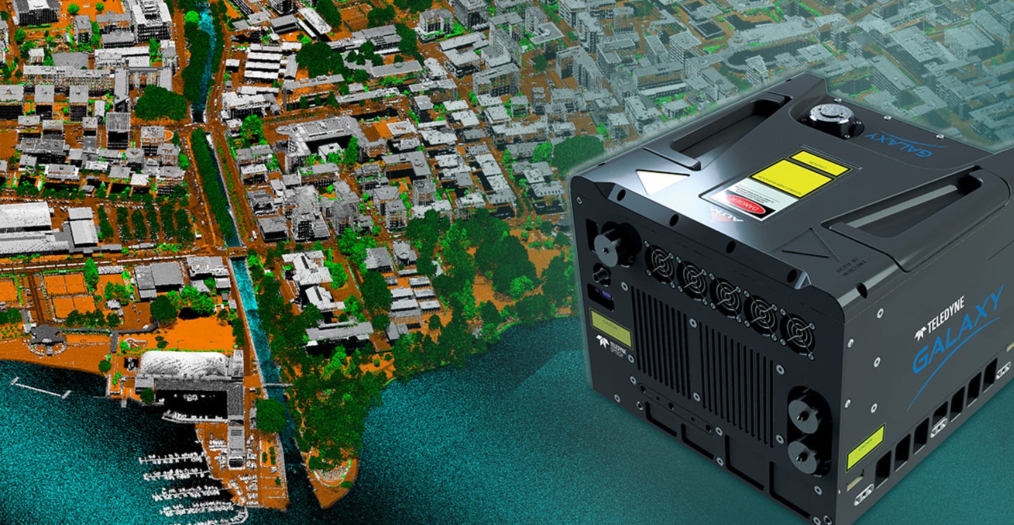
In addition, the solution responds to market needs for uniform point density by accelerating the scan speed and delivering straight and parallel scan lines, the company said.
Contact: Jennifer Parham, Teledyne Geospatial, jennifer.parham@teledyne.com.
Spire Wins Canadian Ship Tracking Contract
Spire Global SPIR 6.38%↑ was awarded a 1.41 million Canadian dollar contract by the government of Canada for global automatic identification system (AIS) ship tracking data. The one-year contract includes options for two additional years, extending the total potential contract value to nearly Canadian $4.23 million. Under the contract, Spire will offer global ship tracking data, providing visibility in both open oceans and high-traffic zones, the company said.
Contact: Sarah Freeman, Spire, comms@spire.com, www.spire.com.
Ubisense Unveils Dual UWB And RTK-GPS Technology
Ubisense has launched its Dimension4 RTK-Tag that uses both Ultra-Wideband (UWB) and signal-corrected RTK-GPS to track assets across both indoor and outdoor areas with up to 5-centimeter accuracy, the company said. The new RTK-Tag supports both Ubisense and third-party transit yard management solutions that address common industry challenges such as space constraints, parking strategies that enable on-time dispatch, and the increasing complexity of maintenance and charging operations with the electrification of fleets, the company said.
Contact: Ubisense, www.ubisense.com.
People
- Xavier Orr is retiring as co-CEO of Advanced Navigation.
- Sammy Loitto has resigned as CEO of Quuppa due to health reasons, according to his LinkedIn.
- u-blox has announced that Camila Japur is its new CFO and member of the executive committee.
- HERE Technologies has appointed Adeel Manzoor as COO. Manzoor was the company’s CFO.
- Point One Navigation has named Tom Weeks as COO.
- Dana Goward, Resilient Navigation and Timing Foundation president, has been named a fellow of the Royal Institute of Navigation.
- Gerd Bitterlich has been named CEO at Mercedes-Benz Vietnam.
- James Thomas has been named Comtech’s CMTL 7.65%↑ vice president of government affairs.
- CalAmp has named Paul Washicko as our new senior vice president of product management.
- KORE has named Bruce Gordon as executive vice president and COO.
- Nicholas Kammes has been named vice president of sales, Eastern US and Canada at Telit Cinterion.
- CONTROLTEK has promoted Wade Holman to vice president of strategic accounts, North America.
- Glympse has promoted Nick Kirkman to director, solutions engineering.
- Seongho Hong has been named director of sales and business development at Visteon Corp.
- EnVue Telematics has named David Press as director of sales.
Jobs
Vice President Marketing. Kontakt.io.
Senior Business Development Manager Ecosystem – Europe. Swift Navigation.
Strategic Sales Manager (Enterprise Sales). TomTom.
Strategic Enterprise Sales Japan. TomTom.
Sales Development Representative. Hivemapper.
Sales Manager – Machine Control. CNH.
Connectivity / PAAS Sales Manager. Quectel.
Sales Development Representative. Woolpert.
Sr. Vehicle Controls Algorithm Engineer. Aptiv.

Click HERE to Join our growing Location Business News LinkedIn Group!
