Send your news releases to kdennehy@driverlessreport.com. Go to www.locationbusinessnews.com for more news and an archive of stories.
JAXA Selects Spirent’s PNT Simulation Solution to Support Lunar Navigation Program
Spirent Communications has announced that the Japan Aerospace Exploration Agency (JAXA) has selected the company to provide a lunar PNT simulation solution. The pioneering technology will support JAXA’s lunar exploration initiatives and contribute to the development of critical navigation infrastructure for future missions on the Moon, the company said. Spirent’s said its PNT X solution enables JAXA to simulate lunar PNT services in before they become operational on the Moon—in compliance with the emergent LunaNet specification.
Contact: Sherri Walkenhorst, for Spirent, (801) 373-7888,
sherriw@connectmarketing.com.
TomTom Extends Collaboration With Sumitomo Electric
TomTom [TOM2] is extending its collaboration with Sumitomo Electric. The companies will offer a traffic light optimization solution powered by TomTom’s technologies, though the companies did not reveal who is doing what.

In other TomTom news, the company and UK-based fleet technology provider CMS SupaTrak have partnered to use TomTom’s SDK to integrate turn-by-turn navigation into SupaTrak’s JobTrak Route Management solution. TomTom said the integrated solution helps customers optimize their routes, reduce fuel costs, lower emissions, and improve driver behavior.
Drone Nerds Partners With Wingtra for Aerial Surveying and Mapping
Drone Nerds has partnered with Wingtra, the Swiss-based producer of the WingtraOne GEN II mapping drone. The companies will offer aerial surveying and mapping capabilities for customers in urban planning, mining, construction, agriculture, and environmental monitoring markets. Drone Nerds will integrate WingtraOne GEN II drones into its service offerings, the company said.
Contact: Cara Ferreira, Drone Nerds, (786) 708-7809, caraf@dronenerds.com, www.enterprise.dronenerds.com.
Inertial Labs Unveils Anti-Jamming CRPA System for Assured Navigation
Inertial Labs, now owned by VIAVI Solutions $VIAV has launched its M-AJ-QUATRO anti-jamming antenna system. The solution is equipped with Controlled Reception Pattern Antenna (CRPA) and digital processing technologies, the company said.
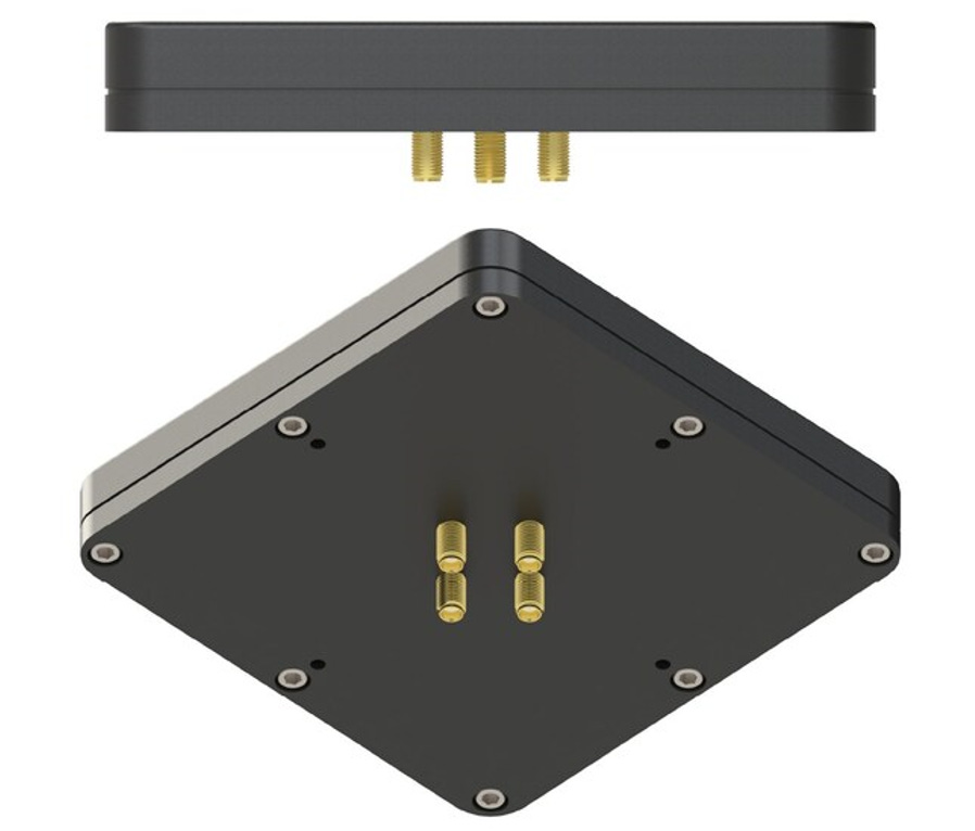
The M-AJ-QUATRO operates across L1, L2, and L5 GNSS bands, has adaptive digital nulling, and suppresses jamming signals with over 34dB+ interference suppression (export-free version) and over 45dB+ interference suppression (export-controlled version), the company said.
Contact: Emma Jenkins, for Inertial Labs, (415) 800-4529, emma@grandbridges.com.
Topcon Positioning Systems Offering New Products at Bauma 2025
Topcon Positioning Systems will exhibit new products at the Bauma 2025 construction show, April 7-13, in Munich, Germany. Topcon’s stand will feature its MC-Max excavator system with Layout Navigator.

Other Topcon products to be displayed include its new HiPer XR GNSS receiver, Tierra telematics and fleet management solutions. The company will also display GNSS correction services for survey and mapping through its Topnet Live.
Contact: Staci Fitzgerald, Topcon Positioning Systems, (925) 245-8610, corpcomm@topcon.com, www.topconpositioning.com.

Create a FREE ManyMe Account.
Suntech GPS Tracker Certified by Carriers
Suntech International USA has announced that its ST6560 GPS Tracker is certified on AT&T T 1.77%↑, T-Mobile TMUS 1.34%↑, and Verizon VZ 1.67%↑ for IoT real-time vehicle and fleet management.
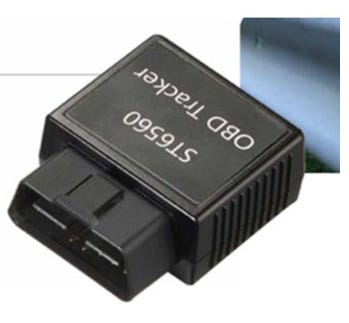
Key features include GPS with dead reckoning support, advanced telematics standard OBD, Bluetooth gateway, monitor and motion sensors and battery backup. The company says the tracker has LTE Cat M1 and NB2-IoT compatibility.
Contact: Suntech International USA, info@suntechus.com, www.suntechus.com.
Garmin G3000 PRIME Selected for Military Training Aircraft
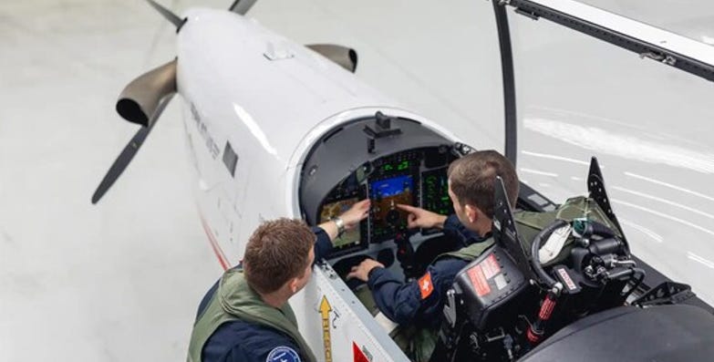
Garmin GRMN 0.07%↑ has announced its G3000 PRIME tandem integrated flight deck has been selected by Pilatus for its PC-7 MKX military training aircraft. G3000 PRIME will integrate with three third-party custom user-defined cockpit displays to provide a Primary Flight Display (PFD), Multi-Function Display (MFD) and Engine Indication System (EIS) display, the company said.
The Runway Occupancy Awareness (ROA) feature analyzes GPS and ADS-B traffic information relevant to the airport’s runways and taxiways to assess and alert the flight crew of a possible runway incursion or collision, the company said.
Contact: Mikayla Minnick, Garmin, (913) 397-8200, media.relations@garmin.com, www.garmin.com.
3D-Printed, Kamikaze Drone Completes Flight
Cummings Aerospace‘s Hellhound S3, a turbojet-powered, 3D-printed kamikaze drone that flies faster than 375 mph, completed a demonstration at the Army Expeditionary Warrior Experiment (AEWE) 2025. Hellhound S3 is an unmanned aircraft system (UAS) designed to equip the U.S. Army’s Infantry Brigade Combat Teams (IBCTs) with the same combat power as armored brigades, the company said.
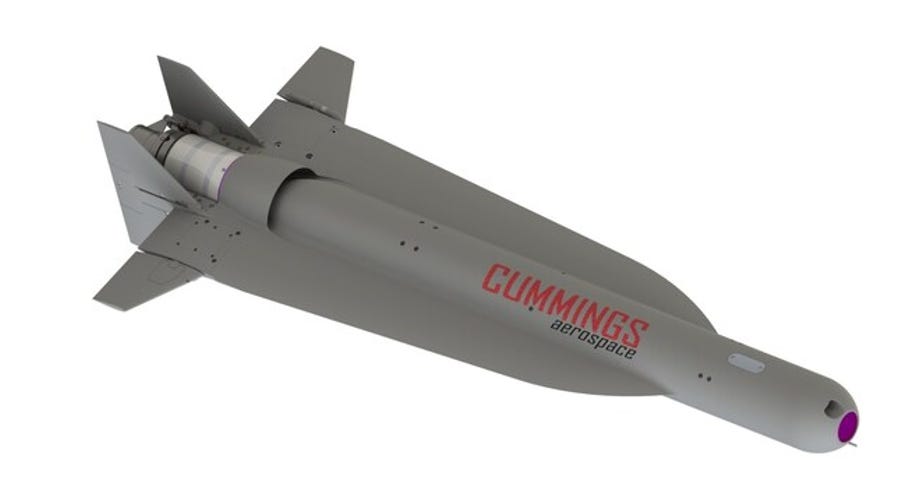
The demonstration included one GPS-guided tactical mission using an inert warhead payload, the company said. The system, which weighs less than 25 pounds, allows a single soldier to carry.
Contact: Cummings Aerospace, https://cummingsaerospace.com.

Click HERE to Join our growing Location Business News LinkedIn Group!


