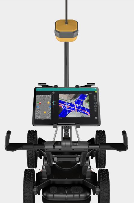

At the conference, Topcon Positioning Systems said it is using Proceq advanced ground penetrating radar (GPR) systems to be used with Topcon GNSS solutions and mass data workflow software.
The manufacturer introduced its new HiPer S1 and value-tier HiPer V1 GNSS receivers, which feed field data directly into office processing pipelines. Topcon also launched Delta Watch, a cloud platform powered by GEOvis for automated structural and deformation monitoring.
Advanced Sensors, Spatial Capture Lead Product Launches
Among the major technical rollouts, spatial intelligence firm XGRIDS introduced its flagship Lixel L3 spatial scanner. The hardware sets a new standard for high-accuracy portable scanning, delivering a validated 5-millimeter relative precision to accelerate detailed reality capture.
In the aerial mapping segment, GeoCue expanded its drone-based portfolio with the launch of the TrueView 550 aerial lidar system. The high-performance unit integrates dual cameras and two distinct positioning options, allowing surveyors to capture colorized, highly accurate 3D point clouds in a single flight.
Laser measurement specialist RIEGL unveiled the miniVUX-4UAV, a miniaturized lidar sensor optimized for drone deployment. The compact system operates at a laser pulse repetition rate of up to 400 kilohertz while maintaining a measurement precision of 8 millimeters.
Concurrently, Ouster and confined-space drone pioneer Flyability showcased the field results of their ongoing lidar partnership. The collaboration integrates Ouster’s digital lidar sensors with Flyability’s indoor drones to improve structural mapping in GPS-denied environments like industrial storage tanks and underground mines.
Legacy Manufacturers Expand Ecosystem Integration
Sokkia debuted its Shared Reality portfolio, led by the new SRS1 and SRS2 handheld scanners for agile 3D point cloud generation. The brand also added the GCX5 and GRX7 GNSS receivers to its lineup alongside the iM-60 and iM-120 manual total stations, emphasizing data consistency between computer-aided design environments and building information modeling workflows.
The conference portion of the event opened with a keynote address by Jack Dangermond, founder and president of geographic information systems giant Esri. Dangermond detailed how structural geographic understanding is becoming a critical prerequisite for sustainable urban development.
- Organizers say that INTERGEO had more than 18,600 attendees from 121 countries, 530 exhibitors from 44 countries and 1,250 conference participants.