The Overture Maps Foundation has announced the Overture Reference System and Data Schema that allows developers to add such features as real-time traffic, road closures, construction information, reviews and ratings on top of the maps.
A structured, documented schema is foundational for anyone who wants to use map data to build applications, said Marc Prioleau, OMF executive director. “It gives an understanding of the structure and naming conventions for the data, allowing a developer to use the data in mapping software in a stable, well-defined way,” he said. “The schema has to be consistent but also expandable. As more types of data are built, we want to be able to extend the schema without breaking its backwards compatibility.”
OMF, founded by Meta $META, Amazon Web Services $AALS, Microsoft $MSFT and TomTom [TOM2], isn’t dangling incentives to Google $GOOG and Apple Maps $AAPL to join, but rather focusing on an open community.
“The reasons to join Overture are not specific to any one company. They are pretty consistent across the board: Overture’s founding premise is that some of the base layers of a worldwide map are best built as a shared, open resource,” Prioleau said. “That could be because the best maps will be the ones that get the best feedback loops and an open community will build that. Or that future map applications will require a shared map database. Or that some layers of the map may just not be worth building and maintaining as a proprietary data set. Those reasons are pretty universally applicable.”
Marc Prioleau, OMF executive director
Prioleau said that OMF believes that most companies will build map services from a mixture of open map data and some unique data, which allows for differentiation. “The companies that are joining Overture are thinking through strategies on how open data can allow them to offer best in class map services while focusing their investments on the data sources and experiences that make their service unique,” he said. “Overture is an open organization. Anyone can join. The main criteria is a commitment to collaboration in building open map data. We also ask members to contribute some combination of data, technology or engineering to support that goal.”
Prioleau said that the data contributions do not have to be map data that goes directly into the map. “Members also contribute ‘precursors’ like street level imagery or aerial imagery or road detections that can be processed in Overture’s pipelines to build or maintain map data,” he said.
While Prioleau admits that OMF doesn’t know the extent of AI’s impact on map building, its biggest impact may be helping maps be updated and modified as conditions change. “We have already seen the impact of AI in photogrammetry where it is used to segment imagery and detect map features, whether that is on aerial, satellite or street level imagery. AI will help expand the precision and speed of that capability, resulting in faster map updates that move towards continuous map updates,” he said. “The same will be applied to movement data to detect patterns and infer meaning about how the world is changing. We are still very early in understanding how Large Language Models will impact mapping but there is massive potential to extract meaning from unstructured data in that area. Generative AI will change the way maps are edited using ChatGPT style interactions.”
Many in the location/mapping industry wonder what impact OMF will have with state and local governments, something that Prioleau says is already happening. “We have been talking to government agencies at all levels to understand how Overture can provide value to them. Many of these agencies make GIS data open so that it can have an impact in their communities,” he said. “The impact grows as those datasets are used across a wide range of applications. Today, the datasets are put in an open data portal, but their utility is limited because those datasets are not connected to other data sets to become a widely usable product. As a simple example, open data on road centerlines for a city becomes much more useful if it is joined to similar data sets in adjacent cities creating a navigable map that spans city boundaries.”
Not all open government data goes directly into the map, Prioleau said, but it can often be used to build map data when combined with some of the data pipelines that Overture is building. “We have seen this already with the USGS 3DEP lidar data. Overture partners used the aerial lidar data with open building footprints to build over 20 million 3D buildings in the United States.”
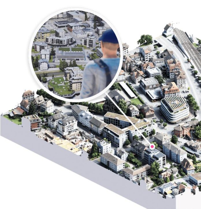
In other OMF news, Nomoko, a provider 3D data technology, announced that they have joined the organization as a contributor member. Nomoko said it will collaborate with the existing “steering members” to create interoperable, accessible 3D datasets.
