BAE Systems demonstrates next-generation M-Code Increment 2 GNSS User Equipment Tech
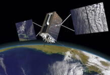
BAE Systems demonstrated M-Code signal tracking with an Increment 2 GNSS receiver powered by the company’s Next-Generation Application Specific Integrated Circuit (ASIC). This demonstration was part of the Military GPS User Equipment (MGUE) Increment 2 Miniature Serial Interface (MSI) program, the company said.

BAE Systems, which won a $247 million U.S. Space Force contract for the system in 2020, says Increment 2 is “a significant leap forward in core signal processing capability and supports advanced signal processing.” The demonstration also builds on the company’s Selective Availability Anti-Spoofing Module (SAASM) and M-Code Increment 1 products.
Contact: Shelley Walcott, BAE Systems, (603) 508-9107, shelley.walcott@baesystems.us, https://baesystems.com/gps.
HERE Navigation Powers Connected Driving Experience in Dacia’s Duster and New Spring
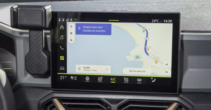
HERE Technologies has announced that Renault brand Dacia has selected HERE Navigation to power the new Duster, sport utility vehicle and New Spring electric car. HERE Navigation is a cloud-based navigation application for connected vehicles.
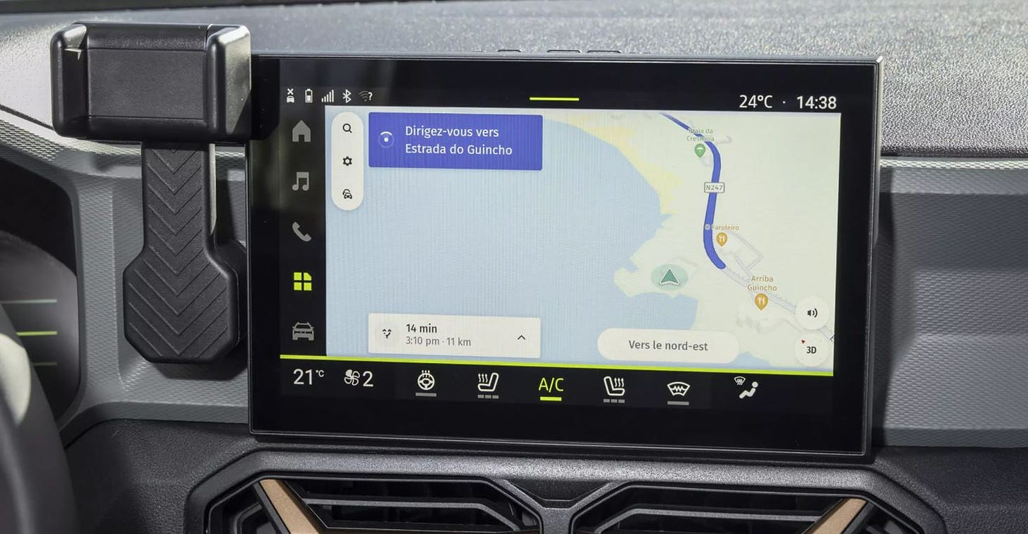
Duster and New Spring drivers will now have automotive-grade maps, online and offline search, real-time traffic information, and turn-by-turn voice guidance in an easy-to-use interface, the company said. The application’s over-the-air update capabilities offer drivers fresh map content and latest service updates, the company said.
Contact: Sebastian Kurme, HERE Technologies, 49 173 515 3549,
sebastian.kurme@here.com.
Geotab Partners With EROAD To Provide Solutions to Fleet Managers

The product will be introduced in New Zealand and Australia, targeting fleet operators who need a solution to track and manage their vehicles, the company said. Geotab’s partnership with EROAD, which is one of the largest telematics providers in the Australia and New Zealand markets, seeks installations with estimated 800,000 light commercial vehicles in those countries, the company said.
Contact: Geotab, www.geotab.com/au.
Topcon Positioning Systems Expands Topnet Live
Topcon Positioning Systems has expanded its reference station service, Topnet Live, to California, Hawaii, Oregon, Nevada, Utah and Washington. This brings a total of 180 full-wave geodetic reference stations added to the network, the company said.
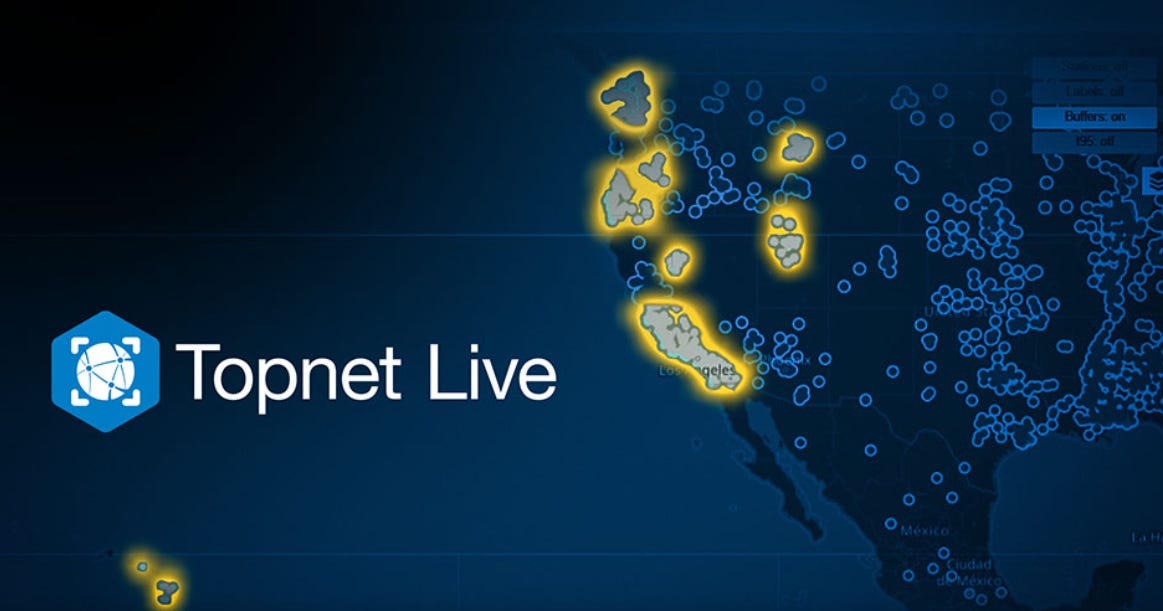
The network corrections offer centimeter accuracy for high-end engineering, surveying, construction and agriculture measurement and guidance systems, the company said. The service is used for such markets as turf industry, for automated mowing and input applications, line marking and imaging, as well as UAV operation for mapping and delivery.
Contact: Staci Fitzgerald, Topcon Positioning Systems, (925) 245-8610, corpcomm@topcon.com.
Rand McNally Introduces Practical AI
Rand McNally has rolled out its Practical AI framework within its SafetyDirect solution that uses machine learning to analyze driver and vehicle performance data. Practical AI features an Automated Event Ranking that classifies and prioritizes safety events, the company said. AER leverages data collected from proprietary onboard ADAS systems, ranking safety events—such as sudden braking, lane departures, and other driving behaviors—based on their severity, the company said.
Contact: Rand McNally, www.randmcnally.com/for-the-fleet.
Kia Launches CarPay and Partners With Parkopedia for In-Car Parking Payments
Kia has launched CarPay in-car payment service that enables customers to pay for items and services from inside the vehicle, starting with the EV3, the company said. The first application available will be with Parkopedia, which will allow European users to locate available parking and pay for it conveniently through the vehicle’s navigation screen.
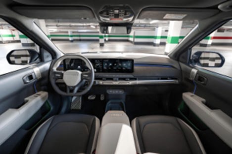
Parkopedia services, available in 19 European countries, are integrated into vehicle navigation systems for seamless operation and help drivers to find the nearest available parking spot at their destination, the company said. The EV3 and all future Kia models will feature CarPay.
Contact: Adam Calland, Parkopedia, 44(0)7838219129, adam.calland@parkopedia.com, https://business.parkopedia.com.
Airista Awarded Asset Tracking and Management Solutions Contract With Premier
Real-time location services provider AiRISTA has been awarded a national group purchasing agreement for asset tracking and management solutions with healthcare company Premier. The agreement allows Premier members to receive special pricing and terms for AiRISTA’s suite of RTLS hardware and software solutions, the company said. The agreement also provides discounted prices for hardware and software products provided by AiRISTA.
Contact AiRISTA, salesinfo@airista.com.

Create a FREE ManyMe Account.
Suntech Launches ST4410G Carton Box Tracker
Suntech International USA has expanded its tracker portfolio with the ST4410G carton box tracker. Use cases include cargo tracking, recovery and real-time visibility on shipments, supply chain and more, the company said.
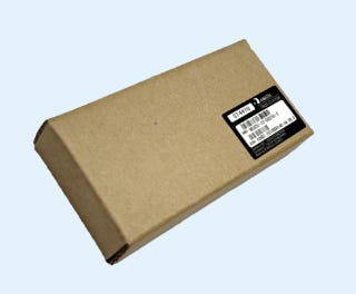
This device, manufactured in South Korea, has already shipped with Suntech do Brasil and Suntech México. The company says the certified device is going to be launched for the North American market.
Contact: Tim Newburg, Suntech USA, tnewberg@suntechus.com, www.suntechus.com.
Kontakt.io Launches New Mobile Apps for Hospital Asset Tracking
Kontakt.io has introduced two new mobile applications to help hospitals cut time responding to staff duress alerts and expedite equipment searches for patient care, the company said. With the Kio Staff Safe Alerts mobile app, security personnel can receive alerts triggered by the wearable BLE staff badge. The Kio Nurse mobile app helps caregivers and biomedical teams locate any asset with a live map view.
Contact: Olivia Wang, Kontakt.io, x.wang@kontakt.io.
Disrupt-X and ORBCOMM Partner on IoT Services
Disrupt-X has partnered with ORBCOMM to integrate ORBCOMM’s IoT services into the ALEF platform. The platform will now have added asset tracking, monitoring, and remote management.

Disrupt-X allows ALEF users to monitor assets in real-time and manage them remotely, even in areas with poor cellular connectivity, the company said. The partnership was signed at Gitex Global 2024 in Dubai this month.
Contact: ORBCOMM, www.orbcomm.com.
Arduino Partners With Truesense
Arduino has partnered with Truesense to integrate Truesense’s UWB technology for smart IoT and industrial real-time tracking systems capabilities into its hardware products, software solutions, and cloud services. “We are combining the accuracy and secure ranging of our UWB technology with the leading open-source ecosystem, to provide developers with powerful tools to quickly build robust smart IoT and industrial real-time tracking systems,” said Armando Caltabiano, Truesense CEO, in a statement.
Contact: Truesense, info@truesense.it, www.truesense.it.
Teledyne Geospatial Rolls Out Coastal Mapping Solution
Teledyne Geospatial will launch its Fathom coastal mapping solution at HYDRO 2024, in Rostock-Warnemünde, Germany, November 5-7. Fathom features a lidar sensor for deep and shallow water bathymetry.

Fathom also includes a built-in topographic lidar and a multispectral camera for coastal survey at a coverage of 50 km2/per hour.
Contact: Jennifer Parham, Teledyne Geospatial, jennifer.parham@teledyne.com.
People
- Drone company ZenaTech ZENA -2.79%↓ has named Philander Franklin, vice president of business development for the Americas. Simon Henry was named vice president of business development for EMEA and Steve Rhode was appointed director of software sales and customer support.
- Ericsson ERIC -1.30%↓ announced that MajBritt Arfert, the company’s chief people officer, will step down at the end of May 2025.
- Roger Lanctot has started a new position as an advisor at Mavi – OnMyWay Commerce.
- LoRa Alliance has announced the appointments of Alper Yegin as CEO and Olivier Beaujard as board chair.
- Cambridge Mobile Telematics has appointed Eric Notteau as senior director for Spain and Portugal.
- Brett Kruger has been named manager, safety critical systems at Hexagon’s Autonomy & Positioning division.
Jobs
Associate Manager of Marketing Operations. Trimble.
Strategic Marketing Manager. Trimble.
Mobile Mapping Sales Consultant. KOREC Group.
Product Manager – Maps and Location Referencing. TomTom.
Product Manager – Analytics. TomTom.

Click HERE to Join our growing Location Business News LinkedIn Group!
