Send your news releases to kdennehy@driverlessreport.com. Go to www.locationbusinessnews.com for more news and an archive of stories.
Alliance for Automotive Innovation Joins GPS Innovation Alliance
The GPS Innovation Alliance (GPSIA) has announced that Alliance for Automotive Innovation is its newest affiliate. GPSIA Executive Director Lisa Dyer said positioning and navigation are critical for the automotive industry—and future systems from low Earth orbit will be key enablers for connected vehicles. Alliance for Automotive Innovation joins 12 other national organizations in GPSIA’s affiliates program, the organization said.
Contact: Geoff Vetter, for GPS Alliance, geoff.vetter@clyde.us, www.gpsalliance.org.
Cavli Wireless Launches IoT Module with GNSS Capabilities
Cavli Wireless has launched its Autograde AQ20 IoT Module to deliver LTE Cat 4 connectivity. The AQ20 module features LTE Cat 4 with fallback to 2G networks, offering downlink speeds of up to 150 Mbps and uplink speeds of up to 50 Mbps, the company said.

Its GNSS capabilities, powered by Qualcomm QCOM -0.36%↓ Location Suite Gen8C Lite, support GPS, GLONASS, Galileo, BeiDou, QZSS, and SBAS constellations. Applications include fleet management and vehicle tracking.
Contact: Abhinand Dinesh, Cavli Wireless, 91-9605750306, abhinand.dinesh@cavliwireless.com, www.cavliwireless.com.
u-blox Launches NORA-B2 BLE Modules
Thalwil, Switzerland-based u-blox has introduced six new variants of the NORA-B2 Bluetooth Low Energy modules. Integrating Nordic Semiconductor’s nRF54L series of wireless Systems-on-Chip (SoCs), NORA-B2 offers a solution for mass market segments because of its antennas, architectures and chipsets, the company said.
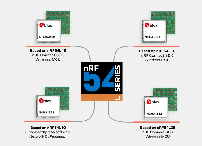
The modules’ IoT applications include smart home devices, industrial automation, or healthcare. All NORA-B2 modules are designed for PSA-certified Level 3 security. Samples of NORA-B20 are now available, the company said.
Contact: Sven Etzold, u-blox, 41 76 561 0066, sven.etzold@u-blox.com, www.u-blox.com.

Create a FREE ManyMe Account.
Topcon Launches HiPer XR GNSS Survey and Mapping Receiver
Topcon Positioning Systems has announced the launch of the HiPer XR, its latest GNSS receiver for surveying, mapping, and construction applications. The receiver is designed for construction professionals, surveyors, GIS professionals, archeologists, engineering firms, and others, the company said.
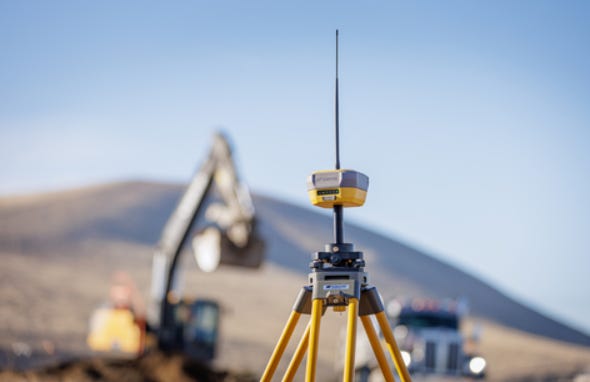
The receiver has TILT (Topcon Integrated Leveling Technology) compensation featuring a calibration-free and magnetic interference-immune integrated IMU that provides up to 60 degrees of tilt for precision measurements in challenging positions, the company said. In addition, the receiver offers signal integrity protection, anti-jamming and anti-spoofing capabilities
Contact: Staci Fitzgerald, Topcon Positioning Systems, (925) 245-8610, corpcomm@topcon.com, www.topconpositioning.com.
Phunware Mobile Hospitality Solution Deployed at JW Marriott Phoenix Desert Ridge Resort & Spa
Phunware PHUN -2.32%↓ has announced today that JW Marriott Phoenix Desert Ridge Resort & Spa is deploying its Smart Hospitality Solution. The app will provide JW Marriott Desert Ridge guests using iOS and Android operating systems with real time navigation capabilities across 950 guest rooms and meeting space, restaurants, golf club and other features, the company said.
Contact: Joe McGurk, Phunware, (917) 259-6895, phun@mzgroup.us, www.phunware.com.
Teledyne Geospatial Launches Fathom Coastal Mapping Solution
Teledyne Geospatial has launched Fathom, a coastal mapping solution for topo-bathymetric surveys that leverages Optech‘s advancements in sensor miniaturization, real-time processing, and production workflow acceleration.
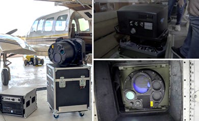
Fathom was developed in response to feedback from government and engineering organizations identifying that crucial geospatial data is missing for the management of resources and infrastructure on land, intertidal zone, and seafloor, the company said.
Contact: Jennifer Parham, Teledyne Geospatial, jennifer.parham@teledyne.com.
Lytx Launches Two Safety Recognition Tools
Lytx has launched two new features for fleet managers to recognize and reward top performing drivers. The new features are integrated into the company’s Driver Safety Program and are part of a suite of safety recognition tools that Lytx will deliver throughout 2025, the company said.

With the Safe Driving Trend Dashboard, fleet and safety managers can monitor fleet safety performance at a glance, the company said.
Contact: Jason Andersen, Lytx, corpcomm@lytx.com, www.lytx.com.
OKI Launches SHO-XYZ Location and Inventory Management System
OKI will launch its SHO-XYZ location and inventory management system, next month in the Japanese market, to track products, equipment, and other items stored indoors and outdoors from a smartphone. The system allows the centralized management of storage locations and inventory information via smartphones by attaching QR Codes or RF tags to items, the company said. Using QR Codes and barcodes, the system can address both location tracking and inventory management, the company said.
Contact: Oki Electric Industry, press@oki.com, www.oki.com/global.

Click HERE to Join our growing Location Business News LinkedIn Group!


